Andhra Pradesh Village Maps Online – How to View Village Boundaries and Survey Maps
Digital land-record and mapping services have made it easier for landholders, farmers, buyers and other users to understand the location and recorded boundaries of land in Andhra Pradesh. Along with textual land records such as ROR-1B and Adangal, maps can provide useful spatial information about villages and individual survey parcels.
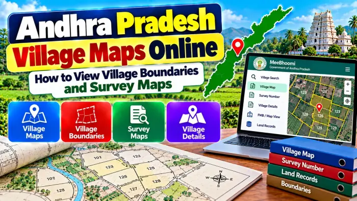
The Government of Andhra Pradesh maintains survey records such as Village Maps, Field Measurement Books (FMBs), Re-Settlement Registers (RSRs) and other land registers. The state's BhuNaksha system is designed for cadastral mapping and provides digital access to available parcel maps.
With Andhra Pradesh Village Maps Online, users can explore available village and survey-map information and connect it with relevant land-record details. However, online maps are primarily useful for record reference and preliminary verification. A digital map should not automatically be considered a substitute for official field measurement or boundary demarcation.
Andhra Pradesh Village Maps – Quick Overview
| Details | Information |
|---|---|
| State | Andhra Pradesh |
| Main Map System | BhuNaksha |
| Map Type | Cadastral / Parcel Maps |
| Village Maps | Maintained by Survey Department |
| Main Parcel Identifier | Survey Number |
| Subdivision Details | May be available |
| FMB | Field Measurement Book |
| RSR | Re-Settlement Register |
| Land Records | MeeBhoomi / applicable land services |
| Administrative Details | District, Mandal and Village |
| Village Boundary Data | Available through applicable GIS systems |
| Parcel Mapping | BhuNaksha |
| Physical Demarcation | Requires applicable survey process |
| Legal Verification | Check certified records where required |
What Is an Andhra Pradesh Village Map?
A village map is a survey record representing land and geographical information within a particular village.
Depending on the type and age of the survey record, a village map can help identify land parcels, survey numbers, boundaries and other survey-related features.
Village maps are useful because land records are organized geographically. Knowing the correct district, Mandal and village helps users locate the appropriate survey information.
The Andhra Pradesh Survey, Settlements and Land Records Department is responsible for maintaining and updating important survey records, including Village Maps, FMBs, RSRs and Land Registers.
What Is BhuNaksha Andhra Pradesh?
BhuNaksha is a cadastral mapping system used by the Government of Andhra Pradesh's Survey, Settlements and Land Records Department.
The system was developed by the National Informatics Centre for digital parcel-map management.
BhuNaksha is designed to make land maps more accessible and to connect spatial land information with existing land-record systems.
It can help users examine available cadastral information for land parcels and understand how a survey parcel is represented on the map.
What Is a Cadastral Map?
A cadastral map is a land map showing individual land parcels within a surveyed area.
Unlike a normal road or navigation map, a cadastral map focuses on property parcels and survey information.
Individual parcels can be represented using survey or plot references, boundaries and other spatial details.
Cadastral maps are particularly useful when users need to understand where a particular survey parcel appears relative to nearby parcels.
However, the lines visible on a digital cadastral map should not automatically be used to physically mark a disputed boundary on the ground.
What Details Do You Need to View a Village Map?
Before searching for a village or survey map, collect the location and property details from your existing documents.
Useful information can include:
District
Mandal
Village
Survey Number
Subdivision Number, where applicable
Khata Number, if available
Pattadar or recorded holder information
You may find these details in your registered deed, ROR-1B, Adangal/Pahani, Pattadar Passbook, FMB or another official land document.
The correct village and survey number are particularly important for identifying the intended parcel.
How to View Andhra Pradesh Village Maps Online
Start with the official Andhra Pradesh cadastral mapping or land-record system.
Choose the appropriate district and other administrative details requested by the platform.
Select the Mandal and village where the land is located.
Use the survey or plot-selection tools available on the map.
After selecting the relevant parcel, review the available map and associated plot information.
The exact interface and available records can vary as government systems are updated or as additional survey data is digitized.
If the required village or parcel is not available digitally, the concerned Survey & Land Records office may need to be contacted.
How to Find Land Using Survey Number
A survey number is one of the most important references for finding a parcel on a cadastral map.
First, select the correct district, Mandal and village.
Then locate or enter the applicable survey number using the available map tools.
Where a survey parcel has subdivisions, make sure you identify the correct subdivision rather than relying only on the original survey number.
After locating the parcel, compare it with the survey number shown in your registered deed and other land records.
This can help reduce the possibility of checking an unrelated parcel.
What Is a Village Boundary?
A village boundary represents the geographical or administrative extent associated with a village in the applicable mapping system.
Andhra Pradesh government geospatial services include administrative boundary layers for the state, districts, Mandals and villages.
These layers can be useful for planning and geographical reference.
However, an administrative village boundary and an individual private property boundary are different things.
If you need the boundary of a specific private parcel, cadastral records, FMB information and an official survey may be more relevant.
Village Map vs Survey Map
The terms village map and survey map can sometimes be used broadly, but they should not always be treated as exactly the same record.
A village map provides a wider view of survey parcels and geographical information within a village.
A detailed survey or parcel record can focus on an individual survey number or subdivision.
For property-level verification, a landholder may need to examine both the broader village map and more detailed records such as FMB information.
What Is an FMB?
FMB stands for Field Measurement Book.
It is an important survey record containing measurement-related information associated with surveyed land.
The Andhra Pradesh Survey & Land Records Department maintains FMBs along with village maps and other survey records.
FMB information can become especially important when a landholder needs more detailed measurement information about a parcel or subdivision.
Certified copies of applicable survey records can be obtained through the prescribed government process, subject to availability and applicable requirements.
What Is an RSR?
RSR stands for Re-Settlement Register.
It is another important land and survey record maintained by the Survey & Land Records administration.
RSR information can be useful when reviewing older survey and settlement records.
If a modern digital land record appears different from an older deed or survey reference, historical records such as the RSR may provide additional context.
The relevant record should be interpreted together with current land and registration documents.
Village Maps and MeeBhoomi Land Records
Map information and textual land records complement each other.
MeeBhoomi is associated with digital land-record access in Andhra Pradesh, while BhuNaksha focuses on cadastral mapping.
BhuNaksha is designed to integrate with existing Andhra Pradesh land-record systems, helping connect parcel maps with relevant records.
When verifying a property, compare the survey parcel shown on the map with available ROR-1B, Adangal and other land information.
Using both textual and spatial records can provide a clearer understanding of the property.
Village Map and ROR-1B
ROR-1B is an important Record of Rights document.
It can contain details such as the recorded khatadar, Khata number, survey number, classification and extent of land.
A cadastral map provides a different type of information by showing the spatial representation of a parcel.
Therefore, ROR-1B and the map should be considered complementary records rather than substitutes for each other.
The survey number can be used as an important reference for comparing them.
Village Map and Adangal
Adangal/Pahani is another important revenue record, particularly for agricultural land.
It can contain land and cultivation-related information.
A village or cadastral map, on the other hand, helps users understand the spatial location of the applicable survey parcel.
When checking agricultural land, comparing Adangal information with the correct survey parcel can be useful for preliminary verification.
Can You Use a Village Map to Check Property Boundaries?
A digital cadastral map can help you understand the recorded shape and relative location of a land parcel.
However, it should not automatically be used to establish the exact physical boundary on the ground.
Differences can arise because of old survey records, subdivisions, resurvey operations, missing survey marks or other changes.
If there is a disagreement between neighbouring landholders or uncertainty about the actual boundary, an official survey or demarcation process may be required.
How to Get an Official Land Survey
The Survey & Land Records Department handles survey-related work, including maintenance surveys, subdivision work and demarcation of applicable land.
Landholders who require official boundary identification should use the prescribed survey or demarcation process.
The survey authority can examine relevant maps, FMBs, existing survey points and other records.
The procedure, documentation and applicable charges can depend on the type of request.
For an actual boundary dispute, this process is more appropriate than relying only on an online map screenshot.
What If Your Survey Map Does Not Match Your Deed?
First check the district, Mandal, village, survey number and subdivision carefully.
Then compare the registered deed with ROR-1B, Adangal, FMB and available survey records.
A difference may arise because of subdivision, resurvey, mutation or historical changes in the land records.
Do not assume that one document is automatically correct.
Where the discrepancy cannot be explained, the appropriate Revenue or Survey authority may need to verify the records.
Are All Village Maps Available Online?
Digital availability can vary.
Andhra Pradesh has been digitizing and managing cadastral maps, but historical survey records for some areas may have limitations.
Government Survey Department information notes that records for some villages may not be fully available because older survey materials can be incomplete or damaged.
Therefore, if a particular village map is not available online, it does not necessarily mean that no survey record exists.
The relevant Survey office may be able to provide additional information.
Can an Online Village Map Prove Ownership?
No. A village or cadastral map primarily provides spatial and survey information.
It does not by itself establish complete legal ownership of a property.
For ownership verification, users may need to examine the registered deed, ROR-1B, mutation records, inheritance documents, Pattadar Passbook and other legally relevant records.
Maps are an important part of land verification, but they should be considered together with textual and legal documents.
Frequently Asked Questions (FAQ)
1. What is Andhra Pradesh BhuNaksha?
BhuNaksha is the state's cadastral mapping system used for managing and accessing available parcel maps.
2. Can I view Andhra Pradesh village maps online?
Available cadastral and survey-map information can be accessed through applicable Andhra Pradesh government mapping services.
3. What details are needed to find a land parcel?
District, Mandal, village and survey number are important. A subdivision number may also be required.
4. What is a cadastral map?
It is a map that represents individual land parcels and their survey-related spatial information.
5. What is FMB?
FMB stands for Field Measurement Book and contains important survey measurement information.
6. What is RSR?
RSR stands for Re-Settlement Register, an important survey and settlement record.
7. Can I check a survey number on BhuNaksha?
Available parcel maps can be searched or examined using the survey and location information supported by the system.
8. Is a village boundary the same as my property boundary?
No. A village boundary covers an administrative or geographical area, while a private property boundary relates to an individual land parcel.
9. Can I use an online map to settle a boundary dispute?
An online map can provide reference information, but an official survey or demarcation may be necessary for an actual boundary dispute.
10. Does a village map prove legal ownership?
No. Complete ownership verification requires relevant land, registration and legal records in addition to map information.
Conclusion
Andhra Pradesh Village Maps Online can help landholders, farmers and buyers understand available village boundaries, survey parcels and cadastral information. BhuNaksha provides digital cadastral mapping facilities, while the Survey & Land Records Department maintains important records such as Village Maps, FMBs, RSRs and Land Registers.
For an accurate search, use the correct district, Mandal, village, survey number and subdivision details. Compare the map with ROR-1B, Adangal/Pahani, registered deeds and other applicable records.
Most importantly, remember that an online village or survey map is useful for preliminary land verification but does not automatically establish ownership or exact physical boundaries. Where measurements or boundaries are disputed, use the applicable official survey and demarcation process.