Bhoomi Karnataka Land Records – How to Search RTC by Survey Number
Karnataka has digitized a large part of its agricultural land-record system, making it easier for landowners, farmers, buyers and legal heirs to access important property information. One of the key systems used for this purpose is Bhoomi Karnataka Land Records.
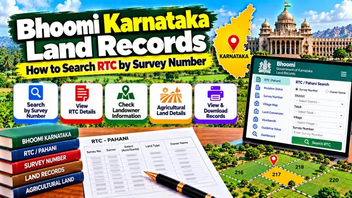
Bhoomi is closely associated with Karnataka's computerized land records, particularly the RTC, commonly known as Pahani. RTC stands for Record of Rights, Tenancy and Crops and contains important revenue information relating to agricultural land.
One of the most useful ways to identify the correct RTC is through the Survey Number. A Survey Number identifies a surveyed land parcel within a particular village. Where the survey parcel has been subdivided, the Hissa Number can also become important.
This guide explains how to search RTC by Survey Number, what information can be found in RTC, how Survey and Hissa Numbers work, and what other documents should be checked when verifying agricultural land in Karnataka.
Bhoomi Karnataka Land Records – Quick Overview
| Details | Information |
|---|---|
| State | Karnataka |
| Land Record System | Bhoomi |
| Main Record | RTC / Pahani |
| RTC Full Form | Record of Rights, Tenancy and Crops |
| Property Type | Primarily Agricultural Land |
| Main Search Detail | Survey Number |
| Additional Identifier | Hissa Number |
| Location Details | District, Taluk, Hobli and Village |
| Landholder Details | Available in applicable RTC |
| Land Extent | Available in land records |
| Crop Information | Available in applicable records |
| Rights Information | Part of applicable RTC data |
| Record Changes | Mutation process |
| Department | Revenue Department |
| Verification | Compare with registered and survey records |
What Is Bhoomi Karnataka?
Bhoomi is Karnataka's computerized land-record system used for managing important agricultural land information.
It forms an important data source for land and farmer-related government systems. Karnataka Government documentation shows that Bhoomi data is used to retrieve information such as Survey Number, land extent and ownership details.
The system has made it easier to maintain and access land records that were traditionally handled through physical revenue registers.
For citizens, one of the most important records connected with Bhoomi is the RTC or Pahani.
What Is RTC in Karnataka?
RTC stands for Record of Rights, Tenancy and Crops.
It is an important Revenue Department record associated with agricultural land in Karnataka.
An RTC can contain information relating to the surveyed land, recorded rights, landholder and agricultural particulars.
Because it contains important information about a land parcel, RTC is commonly checked during land transactions, inheritance, agricultural applications and other land-related processes.
However, an RTC is a revenue record. It should not automatically be considered a substitute for every registered title document.
What Is a Survey Number?
A Survey Number is an identifier assigned to a surveyed parcel or field within a particular village.
It is one of the most important details required when searching Karnataka agricultural land records.
For example, if a person wants to check the RTC for a particular piece of agricultural land, the Survey Number helps identify the relevant parcel.
However, a Survey Number should never be used without its location details.
The same numerical Survey Number may exist in different villages. Therefore, District, Taluk, Hobli and Village should also be verified.
What Is a Hissa Number?
A Survey Number may sometimes be divided into smaller portions.
The identifier used for an applicable subdivision or portion is commonly referred to as a Hissa Number.
Suppose an original survey field is divided between different landholders. The main Survey Number may remain relevant, while separate Hissa references help distinguish the individual portions.
Therefore, when checking an RTC, do not stop after matching the Survey Number.
If a Hissa Number appears in your property documents, compare the complete Survey and Hissa reference.
Details Required to Search RTC by Survey Number
Before searching for an RTC, collect the land information from your existing records.
Important details generally include:
District
Taluk
Hobli
Village
Survey Number
Hissa Number, where applicable
Landholder name
Land extent
An older RTC, registered property document, mutation record or survey document can help you identify these details.
Accurate location information is particularly important for finding the correct parcel.
How to Search RTC by Survey Number
Start with the applicable official Karnataka land-record service.
Choose the option for viewing RTC or Pahani information.
Select the District where the land is located.
Next, select the Taluk.
Choose the relevant Hobli and Village.
Enter or select the Survey Number.
If multiple subdivisions are available, select the correct Hissa Number or applicable subdivision.
Provide any additional information requested by the current system.
Submit the search and review the available RTC information.
The exact interface can change when government digital services are updated, so follow the current instructions shown by the official service.
How to Verify the Correct Survey Number
Do not rely only on memory when entering a Survey Number.
Check the number in your registered deed or existing RTC.
Confirm that the District, Taluk, Hobli and Village also match.
If a Hissa Number is mentioned, verify it carefully.
Then compare the land extent.
This step is important because selecting the wrong subdivision can display information relating to a different portion of the original survey field.
For important transactions, all property identifiers should be consistent across the available documents.
What Information Can RTC Show?
The RTC/Pahani is designed to provide important information relating to agricultural land.
Depending on the applicable record, users can find information associated with:
Recorded landholder or rights
Survey Number
Hissa or subdivision
Land extent
Tenancy-related information
Agricultural or crop details
Other revenue particulars
The exact entries can depend on the property and period.
Crop-related information should also be understood in its proper time context because cultivation can change between seasons.
How to Check Landholder Name
After locating the RTC using the Survey Number, check the section containing the applicable rights or landholder information.
Compare the recorded name with your property documents.
A matching name alone is not enough for complete verification.
You should also compare the Survey Number, Hissa Number, Village and extent.
If a registered transaction has recently taken place but the previous landholder is still displayed, the relevant mutation process should be checked.
Survey Number and Land Extent
Land extent is another important detail to compare when checking an RTC.
Two documents can refer to the same main Survey Number but different subdivisions or extents.
Therefore, check whether the area recorded in the RTC corresponds with the property described in the registered document.
If the extent differs, examine the Hissa information and survey records.
A difference should be investigated rather than ignored, especially before purchasing agricultural land.
Bhoomi RTC and Mutation
A land record may need to change after a sale, inheritance, gift, partition or another qualifying event.
The process of updating applicable revenue rights is commonly connected with mutation.
For example, after agricultural land is sold through a registered transaction, the applicable revenue information may need to reflect the resulting change.
If the RTC still contains an earlier landholder's name, check the relevant mutation information.
Registration of a transaction and mutation of the revenue record are related but distinct processes.
Mutation After Inheritance
Mutation can also become relevant when agricultural land passes to legal heirs.
Applicable succession documents may need to be examined before the revenue record is changed.
If several legal heirs are involved, the resulting entries can depend on the applicable rights and supporting documents.
A dispute among heirs can require additional proceedings.
Therefore, an inheritance-related change should be checked using both the updated RTC and the underlying succession documents.
RTC vs Mutation Record
RTC and mutation records serve different purposes.
The RTC provides the available revenue information relating to the agricultural parcel.
The mutation record helps document a change affecting the recorded rights.
If an old RTC shows one person and a current RTC shows another, the mutation history can help explain how that change occurred.
Checking both records is useful when researching the history of a landholding.
RTC vs Registered Sale Deed
A registered sale deed and RTC should not be treated as identical documents.
A registered sale deed records an applicable property transaction.
The RTC is a Revenue Department land record.
A buyer should therefore compare both documents.
The Survey Number, Hissa Number, land extent and property location should be consistent.
Where the landholder information differs, investigate the mutation and other relevant records.
Searching Survey Details for Agricultural Land
Survey information can be important when there is uncertainty about the exact parcel or subdivision.
Karnataka Government's Land Resource Information system also organizes agricultural and land-resource information at Survey Number level, including soil, crop suitability and other land-resource data.
However, agricultural-resource information and RTC serve different purposes.
RTC is primarily a revenue land record, while specialized land-resource systems can provide additional agricultural or technical information.
What If You Do Not Know the Survey Number?
Start by checking your existing property documents.
A registered deed, old RTC, mutation document or survey record can contain the Survey Number.
You can also review other official property information available for the land.
Do not guess the Survey Number from the landholder's name alone.
Where the property description is unclear, use the applicable Revenue or Survey authority to identify the correct parcel before relying on an online result.
What If RTC Details Are Incorrect?
First make sure you searched the correct District, Taluk, Hobli, Village, Survey Number and Hissa Number.
Then compare the online record with the registered deed, older RTC and mutation information.
A difference may be caused by a pending mutation, subdivision, inheritance change, survey issue or another record discrepancy.
Use the applicable official Revenue or Survey procedure if a correction is necessary.
Avoid unauthorized intermediaries promising instant changes to government records.
RTC Before Buying Agricultural Land
Checking RTC is an important part of preliminary land verification.
Begin with the Survey and Hissa Numbers mentioned in the seller's registered documents.
Find the corresponding RTC.
Compare the landholder information and extent.
Check relevant mutation information.
Where boundaries or measurements are important, review the applicable survey records.
For a major purchase, registration, title and encumbrance-related documents should also be examined before making a final decision.
Does Bhoomi RTC Prove Ownership?
RTC is an important revenue record and can provide useful information about the recorded rights in agricultural land.
However, it should not automatically be treated as standalone conclusive proof of legal title.
Ownership can depend on registered sale deeds, inheritance documents, gift or partition deeds, court orders and other legally relevant records.
For complete property verification, examine the RTC together with mutation history, survey information and applicable registered documents.
Frequently Asked Questions (FAQ)
1. What is Bhoomi Karnataka?
Bhoomi is Karnataka's computerized land-record system associated with important agricultural land and RTC information.
2. What does RTC stand for?
RTC stands for Record of Rights, Tenancy and Crops.
3. Can I search RTC using Survey Number?
Survey Number is one of the main identifiers used to locate a specific agricultural land parcel and its applicable records.
4. What details should I keep ready?
District, Taluk, Hobli, Village, Survey Number and applicable Hissa Number are important.
5. What is a Hissa Number?
A Hissa Number identifies an applicable subdivision or portion within a Survey Number.
6. Can RTC show the landholder name?
Applicable RTC records contain rights and landholder-related information for the selected parcel.
7. Can RTC contain crop details?
RTC/Pahani is associated with agricultural land and can include crop-related information depending on the applicable record and period.
8. What if the previous owner's name appears in RTC?
Check whether the relevant mutation process has been completed and compare the RTC with the registered documents.
9. Is RTC the same as a sale deed?
No. RTC is a revenue record, while a registered sale deed documents an applicable property transaction.
10. Does RTC alone prove ownership?
RTC is important, but complete title verification can require registered deeds, mutation history and other relevant legal records.
Conclusion
Bhoomi Karnataka Land Records provides an important digital framework for accessing agricultural land information, including RTC/Pahani records. Using the correct Survey Number is one of the most effective ways to identify the relevant land parcel.
Before searching, keep the District, Taluk, Hobli, Village, Survey Number and Hissa Number ready. After finding the RTC, compare the recorded landholder, extent and parcel information with your existing property documents.
If a sale, inheritance or another change has occurred, also review the applicable mutation information. Where survey boundaries or measurements are uncertain, additional survey records or official verification may be necessary.
For complete agricultural land verification, use RTC together with mutation history, survey information and registered title documents rather than relying on a single online record.