Karnataka Land Survey Documents Online – Guide to Survey Sketches and Land Measurements
Land survey documents are important when you need to understand the exact identity, measurement, subdivision or boundaries of a property in Karnataka. While RTC/Pahani provides important revenue information, survey records focus more closely on the physical and measurement-related details of a land parcel.
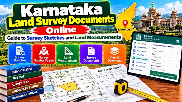
Karnataka maintains several types of survey records and sketches. Depending on the property and purpose, you may encounter documents such as Tippan, Atlas or PT Sheet, Akarband, Phodi Sketch, 11E Pre-Mutation Sketch and Haddubasthu Sketch.
Digital systems such as Mojini have made it easier to request or access applicable survey services and documents. However, every sketch has a different purpose, and an online map should not automatically be treated as a substitute for an official field survey when there is a boundary dispute.
This guide explains Karnataka Land Survey Documents Online, important survey sketches, land measurements and how Survey and Hissa Numbers help identify agricultural land.
Karnataka Land Survey Documents – Quick Overview
| Details | Information |
|---|---|
| State | Karnataka |
| Record Category | Land Survey Records |
| Main Identifier | Survey Number |
| Subdivision Identifier | Hissa Number |
| Basic Survey Sketch | Tippan |
| Survey Register | Akarband |
| Map/Survey Document | Atlas / PT Sheet |
| Subdivision Record | Phodi Sketch |
| Pre-Mutation Document | 11E Sketch |
| Boundary Service | Haddubasthu |
| Related Land Record | RTC / Pahani |
| Survey Service System | Mojini |
| Main Purpose | Parcel identification and measurement |
| Boundary Verification | Official survey may be required |
| Title Verification | Check registered and revenue records separately |
What Are Karnataka Land Survey Documents?
Land survey documents are records used to identify and describe surveyed land parcels.
Unlike an RTC, which focuses on rights, tenancy, crops and other revenue particulars, survey records are especially important for understanding measurements, parcel configuration and subdivisions.
Different survey records can serve different purposes.
For example, a Tippan contains measurement-related survey information, while a Phodi Sketch can be associated with subdivision of land.
These records become particularly important when a large Survey Number has been divided into smaller portions or when there is uncertainty regarding the physical extent of a parcel.
What Is a Survey Number?
A Survey Number is a key identifier assigned to a surveyed parcel within a village.
When checking land records, it should always be read together with the correct District, Taluk, Hobli and Village.
A numerical Survey Number by itself is not enough because similar numbers can exist in different villages.
The Survey Number can appear across RTC, mutation and survey records.
Therefore, matching the Survey Number across these documents is an important part of property verification.
What Is a Hissa Number?
A Survey Number can sometimes be divided into smaller portions.
A Hissa Number helps identify a particular subdivision or portion within that Survey Number.
This becomes important when only part of a larger parcel is sold, inherited, gifted or partitioned.
For example, two landholders may have different portions of land associated with the same main Survey Number.
The Hissa reference helps distinguish those portions.
When available, always compare both the Survey Number and Hissa Number instead of relying only on the main Survey Number.
What Is a Tippan in Karnataka Land Records?
A Tippan is an important basic survey sketch.
It contains measurement information relating to a Survey Number and is used as an underlying survey record for understanding or calculating the parcel's area.
A Tippan may not look like a modern satellite map. It is a technical survey record created for land-measurement purposes.
It can be useful when examining old survey information, understanding measurements or supporting survey-related work.
However, reading a Tippan accurately can require knowledge of survey records and measurement conventions.
What Is Akarband?
Akarband is another important survey record.
It functions as a register containing information associated with Survey Numbers.
The record can include the total extent of land, cultivable and non-cultivable portions and other assessment-related survey information.
Akarband and RTC serve different purposes.
RTC provides revenue and rights-related information, while Akarband forms part of the survey-record framework.
Comparing records can be useful where the extent shown in different documents needs to be understood.
What Is an Atlas or PT Sheet?
An Atlas or PT Sheet is another survey-related document that may be required for identifying the shape, location or survey configuration of a plot.
Karnataka Government documentation for certain land-development applications specifically refers to an Atlas/PT Sheet certified by the competent Revenue authority.
Where multiple Survey Numbers form part of one proposed property or layout, survey-map information can become particularly important.
An Atlas or PT Sheet should be compared with the relevant Survey Numbers and current land documents.
What Is a Phodi Sketch?
Phodi is associated with subdivision of a land parcel.
When a larger Survey Number is divided into separate portions, the survey records may need to be updated to identify those portions properly.
A Phodi Sketch helps represent the resulting subdivision.
This is particularly relevant where part of a property is transferred or where separate holdings need to be distinguished.
Phodi should not be confused with mutation.
Mutation concerns changes in revenue rights, while Phodi concerns survey subdivision. In some land transactions, both processes can become relevant.
What Is an 11E Sketch?
The 11E Sketch, also known as a pre-mutation sketch, is important in certain transactions involving part of a Survey Number.
Its purpose is to identify the specific portion involved in the proposed transaction before the corresponding mutation and related processes.
For example, if only part of a larger Survey Number is being transferred, accurately identifying that portion becomes essential.
The sketch helps distinguish the relevant extent instead of treating the entire Survey Number as the transferred property.
This makes the 11E sketch particularly important for part-extent transactions.
What Is Haddubasthu?
Haddubasthu is associated with boundary identification or demarcation of land.
It becomes useful when a landholder needs the applicable parcel boundaries identified through the official survey process.
This can be important when neighbouring landowners disagree about the location of a boundary or when physical markers are unclear.
An online map or old sketch may provide useful reference information, but it should not automatically replace official field demarcation where a real boundary dispute exists.
How to Check Karnataka Survey Documents Online
Start with Karnataka's applicable official survey and land-record services.
Mojini is associated with survey-related applications and spatial land-record services.
Select the appropriate survey-document or sketch service.
Provide the requested location and land details.
Depending on the service, these can include District, Taluk, Hobli, Village, Survey Number and Hissa Number.
Choose the required document or survey service.
Follow the current instructions displayed by the government system.
Some services may allow viewing of available records, while obtaining an officially issued document or requesting a field survey can involve a separate process.
Details to Keep Ready
Before checking a survey document, collect the correct property details from your existing records.
Keep your District, Taluk, Hobli and Village information ready.
Check the Survey Number.
If the parcel has been subdivided, identify the Hissa Number.
An existing RTC, registered deed, mutation record or previous survey document can help you locate these references.
Where you are requesting a survey after a transaction, the applicable registered documents can also be important.
Survey Sketch vs RTC/Pahani
A survey sketch and RTC should not be treated as the same record.
The RTC/Pahani provides applicable revenue information about agricultural land, including recorded rights and other land particulars.
A survey sketch focuses more on the physical or measurement-related identification of the parcel.
For complete land verification, both types of records may be useful.
For example, RTC can help identify the recorded landholding, while a survey document can help clarify the parcel or subdivision to which that information relates.
Survey Documents and Mutation
Mutation and survey updates can interact when only part of a land parcel changes hands.
If the entire Survey Number is transferred, the situation can differ from a transfer involving only a portion.
When a portion is transferred, the exact extent must be properly identified.
This is where pre-mutation and subdivision sketches can become important.
Mutation deals with changes in the revenue record, while survey processes establish or update applicable parcel and measurement information.
Understanding Land Measurements
Do not rely only on an approximate physical estimate when checking land extent.
Compare the extent mentioned in the registered document with RTC and applicable survey records.
Where a Survey Number has multiple Hissa portions, confirm which subdivision corresponds to your property.
Differences in extent should be investigated carefully.
Old survey records, subdivision history and later survey work can all be relevant when understanding how the present parcel was formed.
Land Survey Before Buying Property
Survey documents can be valuable during land due diligence.
Start by checking the Survey and Hissa Numbers mentioned in the registered documents.
Compare those numbers with the latest RTC.
Review important mutation information.
Then examine relevant survey records where parcel measurement or subdivision needs clarification.
If the physical boundary on the ground appears inconsistent with the documents, consider the applicable official survey or demarcation process before completing an important transaction.
What If Land Measurements Do Not Match?
A measurement mismatch should not be ignored.
First, make sure all documents relate to the same Survey and Hissa Numbers.
Compare the registered deed, RTC and available survey records.
Check whether a subdivision, Phodi or later survey change occurred.
If the issue concerns actual boundaries on the ground, an official survey may be required.
Do not alter physical boundary markers based only on an online map or an informal measurement.
Can Online Survey Maps Confirm Exact Boundaries?
Digital survey information can be very useful for locating and understanding a parcel.
Karnataka also has spatial land-record tools that can help citizens identify survey-number boundaries and connect them with land information.
However, map visualization and legal or physical boundary demarcation are not necessarily the same process.
Satellite imagery can also contain positional differences.
Where exact boundaries are disputed or legally important, use the applicable official survey and demarcation procedure.
Survey Documents and Registered Deeds
Registered deeds and survey documents perform different functions.
A deed records an applicable legal transaction or right.
Survey documents help identify the parcel, measurements or subdivision.
Therefore, one should not automatically replace the other.
During verification, compare the property description in the registered deed with the Survey Number, Hissa Number, extent and applicable survey records.
Any significant inconsistency should be clarified before relying on the documents.
Do Survey Documents Prove Ownership?
Survey documents are important for identifying and measuring land, but they should not automatically be treated as standalone proof of legal ownership.
Legal title can depend on registered sale deeds, inheritance documents, gift or partition deeds, court orders and other legally relevant records.
RTC and mutation history can also provide important revenue information.
For complete verification, survey documents should be examined together with relevant title and revenue records.
Frequently Asked Questions (FAQ)
1. What are Karnataka land survey documents?
They are records and sketches used to identify, measure, map or subdivide land parcels.
2. What is a Tippan?
Tippan is a basic survey sketch containing measurement information associated with a Survey Number.
3. What is a Survey Number?
It is an identifier assigned to a surveyed land parcel within a particular village.
4. What is a Hissa Number?
A Hissa Number identifies an applicable subdivision or portion of a Survey Number.
5. What is a Phodi Sketch?
A Phodi Sketch is associated with subdivision of a land parcel into identifiable portions.
6. What is an 11E Sketch?
It is a pre-mutation sketch used in applicable transactions involving part of a Survey Number.
7. What is Haddubasthu?
Haddubasthu is associated with identifying or demarcating land boundaries through the survey process.
8. Are RTC and survey sketches the same?
No. RTC is primarily a revenue record, while survey sketches focus on parcel identification and measurements.
9. Can an online map settle a boundary dispute?
An online map can provide useful information, but an official survey or field demarcation may be necessary for an exact boundary dispute.
10. Do survey documents alone prove ownership?
No. Ownership verification can also require registered deeds, RTC, mutation history and other legally relevant records.
Conclusion
Karnataka Land Survey Documents Online can help landowners, buyers and legal heirs understand important details about a property's Survey Number, Hissa Number, measurements, subdivision and boundaries.
Documents such as Tippan, Akarband, Atlas/PT Sheet, Phodi Sketch and 11E Sketch serve different purposes within the survey-record system. Haddubasthu can also become important when official boundary identification is required.
Before relying on any survey record, make sure the District, Taluk, Hobli, Village, Survey Number and Hissa Number correspond with your property documents.
For complete verification, compare survey information with the latest RTC, relevant mutation records and registered property documents. If there is a serious measurement or boundary discrepancy, use the applicable official survey procedure rather than relying solely on an online map or informal measurement.