MeeBhoomi Survey Number Search – How to Find Your Andhra Pradesh Land Details Online
Finding the correct survey number is one of the most important steps when checking land records in Andhra Pradesh. A survey number helps identify a particular parcel of land within the relevant village and survey records. Whether you are a farmer, landowner, buyer, legal heir or someone verifying family property, the survey number can help you locate important land information.
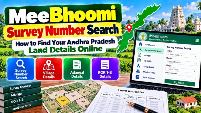
Andhra Pradesh provides digital access to land records through government land-record services such as MeeBhoomi. By selecting the appropriate district, Mandal and village and using the available survey details, users can review land information without depending entirely on physical visits to Revenue offices.
A MeeBhoomi Survey Number Search can help you connect a land parcel with records such as Adangal/Pahani, ROR-1B and Khata information. However, an online land record should be treated as an important source of recorded information rather than automatic proof of final legal ownership.
MeeBhoomi Survey Number Search – Quick Overview
| Details | Information |
|---|---|
| State | Andhra Pradesh |
| Land Record System | MeeBhoomi |
| Main Search Detail | Survey Number |
| Location Details | District, Mandal and Village |
| Related Record | Adangal / Pahani |
| Record of Rights | ROR-1B |
| Account Information | Khata Number |
| Landholder Information | Available in applicable records |
| Land Extent | May be available |
| Land Classification | May be available |
| Survey Maps | Bhunaksha / Survey Records |
| FMB | Survey Department record |
| RSR | Re-Settlement Register |
| Verification | Compare multiple official records |
What Is a Survey Number?
A survey number is an important identifier assigned to land within the applicable survey and village records.
During land survey operations, land is divided and recorded as identifiable parcels. Survey numbers help government departments and landholders identify these parcels.
A survey number can appear in different property documents, including registered deeds, Adangal/Pahani, ROR-1B, Pattadar Passbooks and survey records.
When searching for Andhra Pradesh land details online, the survey number is therefore one of the most useful pieces of information to have.
What Is MeeBhoomi?
MeeBhoomi is an Andhra Pradesh land-record platform used to provide digital access to available land information.
Government district websites in Andhra Pradesh continue to direct citizens to MeeBhoomi for land-record services.
The digital system makes it easier for people to review property information from a mobile phone or computer instead of visiting an office for every basic enquiry.
However, online services and their interfaces can change. Users should follow the options and instructions currently displayed on the official government land-record system.
Why Is the Survey Number Important?
A person's name alone may not be sufficient to identify a particular parcel of land.
Names can be repeated, spellings can differ and a person may hold more than one parcel.
The survey number provides a more specific land reference when combined with the correct district, Mandal and village.
It can also help users compare information appearing in different records.
For example, you can compare the survey number shown in a registered deed with the number appearing in ROR-1B, Adangal and Pattadar Passbook records.
Survey Number and Subdivision Number
A survey number can sometimes be divided into smaller subdivisions.
When a larger parcel is divided, individual portions may be recorded using additional subdivision references.
For example, a property document may contain a main survey number together with a subdivision or Hissa reference.
This additional information can be important.
Two pieces of land connected with the same original survey number may represent different portions after subdivision.
Therefore, always compare the complete survey and subdivision reference when reviewing land records.
What Details Are Needed for a Survey Number Search?
Before starting the search, collect as much information as possible from your existing land documents.
Useful details may include:
District
Mandal
Village
Survey Number
Subdivision or Hissa Number
Khata Number
Pattadar or recorded landholder name
You may find these details in a registered deed, Pattadar Passbook, ROR-1B, Adangal/Pahani or previous survey document.
The correct village is particularly important because the same numerical survey number can exist in different villages.
How to Check Andhra Pradesh Land Details by Survey Number
Start with the official Andhra Pradesh land-record service.
Choose the applicable land-record option, such as the available Adangal, ROR or property-information service.
Select the correct district.
Next, choose the Mandal and village where the land is located.
Use the survey-number search option where available and enter or select the relevant survey number.
If a subdivision is shown, make sure you choose the correct subdivision.
Complete any verification requested by the system and submit the search.
Review the available land information carefully and compare it with your existing documents.
What Details Can You Find Using a Survey Number?
The information available depends on the record being searched.
A survey-number-based land record may help users review details such as the recorded khatadar or pattadar, Khata number, land extent, classification and other revenue information.
Cultivation-related records may contain additional agricultural information.
Survey and mapping records can provide different information relating to parcel measurements and spatial details.
For this reason, one survey number can be used as a common reference when comparing several different land records.
How to Check ROR-1B Using Survey Details
ROR-1B is an important Record of Rights document in Andhra Pradesh.
Government documentation states that the ROR-1B register is maintained village-wise and can contain details such as the khatadar's name, father's name, Khata number, survey number, land classification, extent and land revenue.
When reviewing ROR information, check whether the survey number matches your registered property documents.
Also compare the Khata number and recorded holder information.
A mismatch should be understood before relying on the record for an important transaction.
How to Check Adangal/Pahani Details
Adangal/Pahani is another important Andhra Pradesh revenue record.
It is particularly relevant to agricultural land and can contain information connected with the parcel and cultivation.
After identifying the correct survey number, compare the Adangal information with ROR-1B and the Pattadar Passbook.
This can help identify differences in recorded area, landholder information or other land particulars.
Remember that agricultural or cultivation-related information can change over time, so the relevant record period can also be important.
Survey Number and Khata Number – What Is the Difference?
A survey number and Khata number are not the same.
A survey number identifies a land parcel or survey unit within the relevant village records.
A Khata number relates to the applicable landholding account or khatadar in the revenue system.
Depending on the record, a Khata can be associated with more than one survey parcel.
Therefore, checking both numbers can provide a clearer understanding of the recorded landholding.
How to Check Land Maps Using Survey Number
Andhra Pradesh also provides a cadastral mapping system through Bhunaksha.
The system is maintained by the Survey, Settlements and Land Records Department and is integrated with the state's land-record ecosystem.
Bhunaksha can help users access available land maps and spatial information.
A survey number can be useful when identifying the applicable parcel on a cadastral map.
However, an online map should not be treated as a substitute for an official physical survey when there is a boundary dispute.
What Is FMB?
FMB stands for Field Measurement Book.
FMB is an important survey record used in relation to measurements and parcel information.
The Andhra Pradesh Survey & Land Records Department maintains FMBs along with village maps, Re-Settlement Registers and other land records.
When exact survey measurements or boundary-related information is required, FMB records may be relevant.
Certified copies of applicable survey records may also be available through the prescribed government process.
What Is RSR?
RSR refers to the Re-Settlement Register.
It is another important survey and settlement record maintained by the Survey & Land Records administration.
An RSR can be relevant when researching older land and survey information.
If there is a significant difference between current digital information and older property documents, survey records such as RSR and FMB may help provide additional historical context.
How to Find a Survey Number If You Do Not Know It
If you do not know your survey number, check your existing property documents first.
A registered sale deed, Pattadar Passbook, old ROR-1B, Adangal or other land document may contain the survey reference.
Make sure the document relates to the correct village and property.
If the survey number cannot be identified from your documents or there is uncertainty about the land parcel, the appropriate Revenue or Survey authority may need to assist with record verification.
Avoid guessing a survey number from nearby properties.
What If the Survey Number Is Incorrect?
If the survey number in one record differs from another, first check whether a subdivision, resurvey, mutation or other land-record change explains the difference.
Compare the registered deed, ROR-1B, Adangal, Pattadar Passbook and survey records.
An error in official records may require the applicable correction process through the Revenue or Survey administration.
Do not assume that an online entry can be changed instantly.
Supporting documents and official verification may be required before an accepted correction is reflected in the record.
Survey Number Search Before Buying Land
A survey-number search can be useful for preliminary property verification before buying land.
Check whether the survey number mentioned in the proposed transaction matches the available revenue records.
Compare the village, subdivision, land extent, Khata and recorded holder information.
Also examine the registered deed, mutation history, applicable encumbrance information and other relevant records.
For important transactions, appropriate legal title verification can help identify issues that a basic online search may not reveal.
Does a Survey Number Prove Ownership?
No. A survey number identifies land; it does not by itself prove who legally owns that property.
Even an online revenue record showing a person's name should not automatically be treated as conclusive title proof.
Legal ownership verification may require registered deeds, inheritance documents, mutation records, ROR information, court orders and other relevant records.
The survey number is therefore an important property identifier, but it is only one part of complete land verification.
Frequently Asked Questions (FAQ)
1. What is MeeBhoomi Survey Number Search?
It refers to using survey information to find available Andhra Pradesh land records through the state's digital land-record system.
2. What is a survey number?
A survey number is an identifier used for a land parcel within the applicable village and survey records.
3. What details do I need for a land search?
District, Mandal, village and survey number are among the most important details.
4. Can I check landholder information using a survey number?
Applicable revenue records may show recorded khatadar or pattadar information connected with the land.
5. What is a subdivision number?
It identifies a specific portion created within or associated with a survey parcel.
6. Is a survey number the same as a Khata number?
No. Survey numbers identify land parcels, while Khata numbers relate to landholding accounts in the revenue system.
7. Can I check ROR-1B using survey details?
Survey number is one of the important details recorded in ROR-1B and can help identify the applicable record.
8. Can I check a land map online?
Andhra Pradesh provides Bhunaksha for applicable cadastral map and spatial land information.
9. What should I do if the survey details are wrong?
Compare all available official records and use the applicable Revenue or Survey correction process where necessary.
10. Does a survey number prove land ownership?
No. It identifies land, while complete ownership verification requires examination of the relevant legal and land records.
Conclusion
MeeBhoomi Survey Number Search can help landholders and other users find important Andhra Pradesh land details online. By selecting the correct district, Mandal and village and using the appropriate survey number, users can connect a parcel with available ROR-1B, Adangal, Khata and other land information.
Survey numbers are also useful when comparing registered deeds, Pattadar Passbooks and survey records such as FMB and RSR. For map-related information, cadastral mapping services can provide additional spatial details.
Always check the complete survey and subdivision reference carefully. For buying, selling, inheritance, boundary disputes or other important property matters, compare multiple official records instead of relying on a single online search. A survey number identifies the land parcel, but registered and legally relevant documents are still necessary for complete ownership verification.