Odisha BhuNaksha Online – View Village Maps and Land Plot Boundaries
Land maps are useful when you want to identify the location, shape and recorded boundaries of a particular land parcel. In Odisha, citizens can access digital land-record information and applicable plot maps through the state's online land services.
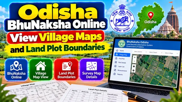
Odisha BhuNaksha Online and the Map View facility available through Bhulekh make it easier to locate cadastral maps using property details. Users can select the District, Tahasil, Village, RI Circle and Plot Number to find the applicable plot map.
A digital cadastral map can help landowners, farmers, buyers and legal heirs understand how a plot appears in the village map and how it is positioned in relation to surrounding parcels. However, an online map should not be confused with an official physical boundary demarcation.
This guide explains how to use Odisha BhuNaksha, view village maps, locate plot boundaries and compare map information with RoR and other land records.
Odisha BhuNaksha Online – Quick Overview
| Details | Information |
|---|---|
| State | Odisha |
| Service | BhuNaksha / Map View |
| Related Portal | Bhulekh Odisha |
| Map Type | Cadastral / Land Parcel Map |
| Village Map | Available for applicable areas |
| Plot Map | Available |
| Main Parcel Reference | Plot Number |
| District Selection | Required |
| Tahasil Selection | Required |
| Village Selection | Required |
| RI Circle | Required in Map View |
| Plot Number | Required for plot search |
| Related Land Record | RoR |
| Khatiyan Information | Available through Bhulekh |
| Physical Demarcation | Separate official process |
| Main Purpose | Land parcel and map verification |
What Is Odisha BhuNaksha?
BhuNaksha is a digital cadastral-map system used in land-record management.
A cadastral map generally represents land parcels within a defined revenue area. Individual parcels are identified through Plot Numbers and displayed in relation to neighboring plots.
Odisha has implemented BhuNaksha-related digital mapping as part of its land-record modernization initiatives.
For citizens, Bhulekh Odisha currently provides a Map View option that can be used to locate applicable village and plot maps.
The map service complements textual land records such as the Record of Rights rather than replacing them.
What Is a Village Map?
A village map is a cadastral representation of land parcels within a revenue village.
It can show how individual plots are arranged and where one recorded parcel lies in relation to another.
Plot Numbers are particularly important on these maps because they help connect a parcel shown on the map with the corresponding textual land record.
Village maps can be useful when researching agricultural land, checking neighboring parcels or understanding the layout of a larger landholding.
However, the map should always be interpreted together with the applicable land records.
How to View Odisha Village Maps Online
Start with the official Odisha Bhulekh land-record system.
Open the Map View facility.
The portal provides an option to view village maps and another section for selecting a location to view a particular plot map.
Choose the appropriate District.
Select the correct Tahasil.
Choose the Village.
Select the applicable RI Circle.
Finally, select the relevant Plot Number.
The system can then display the applicable map information available for that parcel.
Always verify that the location details match your property documents before relying on the displayed map.
Details Required to Find a Plot Map
To locate the correct plot, keep your property details ready before starting the search.
The most important information includes the District, Tahasil, Village, RI Circle and Plot Number.
The Plot Number can often be found in the RoR, registered deed or other applicable land documents.
If you do not know the Plot Number, you can first use Bhulekh's RoR search facilities to locate land information through Khatiyan, Plot or Tenant details.
Once the correct Plot Number is identified, use it to locate the corresponding map.
What Is a Plot Number?
A Plot Number identifies an individual parcel within the applicable revenue village.
It is one of the main references connecting textual land records with cadastral maps.
A Plot Number should never be interpreted without its location.
For example, the same numerical Plot Number may exist in different villages.
Therefore, always verify the District, Tahasil and Village along with the Plot Number.
When available, also compare the Khatiyan and recorded tenant details to make sure you have selected the correct property.
What Is an RI Circle?
RI Circle refers to the applicable Revenue Inspector Circle.
The current Odisha Bhulekh Map View asks users to select an RI Circle along with the District, Tahasil, Village and Plot Number.
Selecting the correct RI Circle helps narrow the map search to the appropriate revenue jurisdiction.
If you are unsure about the RI Circle, first locate the correct land record and village details through the official land-record system or contact the concerned Tahasil for assistance.
How to View Land Plot Boundaries
After selecting the correct location and Plot Number, the digital map can show the parcel within the cadastral layout.
The visible lines around the parcel represent the mapped boundaries between plots in the cadastral record.
Check the selected Plot Number carefully.
Look at the surrounding Plot Numbers and overall parcel shape.
This can help you understand how the selected plot is positioned relative to neighboring land.
For basic record verification, this visual information can be very useful.
BhuNaksha Map vs RoR
BhuNaksha and RoR provide different types of land information.
The BhuNaksha or cadastral map focuses mainly on the spatial representation of parcels.
The Record of Rights (RoR) provides textual revenue information relating to the landholding.
RoR can help identify the applicable Khatiyan, tenant or recorded landholder and associated plots.
For better land verification, compare the map with the corresponding RoR rather than relying on either record in isolation.
How to Match a Map With RoR
First find the correct RoR through Bhulekh.
Verify the District, Tahasil and Village.
Check the Khatiyan and identify the relevant Plot Number.
Review the applicable plot information.
Then open Map View and enter the same location and Plot Number.
Compare the parcel shown on the map with the land description in your documents.
If the Plot Number or other important information does not correspond, investigate the discrepancy before using the record for an important transaction.
How to Find Plot Details Before Opening the Map
Bhulekh provides multiple methods for searching land records.
Users can search using Khatiyan Number, Plot Number or Tenant Details after selecting the relevant District, Tahasil and Village.
This can be useful when you do not have complete map-search information.
For example, if you know the Khatiyan but not the exact Plot Number, check the RoR Back Page to identify the plots associated with the landholding.
You can then use the relevant Plot Number in Map View.
What Is Plot Unique ID?
Odisha Bhulekh also provides a facility to search land using a Plot Unique ID.
If you do not know the unique reference, the system provides an option to identify it using District, Tahasil, Village, Khatiyan and Plot details.
A Plot Unique ID can help distinguish a particular parcel within the digital land-record system.
However, users should still compare the unique parcel information with the RoR and other property documents.
Can BhuNaksha Show Exact Physical Boundaries?
This is an important distinction.
A digital cadastral map shows the parcel boundary recorded in the map database, but viewing the map online is not the same as conducting an official physical boundary demarcation on the ground.
Odisha's Revenue and Disaster Management Department has a separate procedure for demarcation of plot boundaries for recorded tenants.
Therefore, if neighboring landowners disagree about the exact position of a boundary, relying only on an online screenshot may not resolve the issue.
The applicable official demarcation or survey process should be followed.
BhuNaksha for Property Buyers
A cadastral map can be useful when conducting preliminary checks before buying land.
Start with the registered property documents.
Identify the District, Tahasil, Village, Khatiyan and Plot Number.
Check the RoR on Bhulekh.
Then locate the same Plot Number in Map View.
Compare the parcel with the property description and surrounding plots.
Also review applicable mutation, registration, inheritance and other relevant records.
A map can support property verification, but it should not replace a proper examination of title and revenue documents.
BhuNaksha for Inherited Land
Village maps can also help legal heirs identify inherited parcels.
An old family landholding may contain multiple plots under one Khatiyan.
Use the RoR to identify the applicable Plot Numbers and then check each relevant parcel on the map.
If rights have changed through inheritance, check whether the corresponding revenue records have also been updated.
Where several heirs have interests in the property, do not assume that a visual map by itself determines each person's legal share.
What If the Plot Is Not Visible?
First check whether you selected the correct District, Tahasil, Village and RI Circle.
Verify the Plot Number using the RoR.
If the property has undergone subdivision, mutation, settlement or another land-record change, older documents may need to be compared with the current record.
You can also check the Plot Unique ID facility where applicable.
If the correct parcel still cannot be identified, contact the concerned Tahasil or land-record authority instead of guessing a Plot Number.
What If the Map and RoR Do Not Match?
A mismatch should be examined carefully.
Verify the location, Khatiyan and Plot Number again.
Compare the current RoR with older land records, registered documents and applicable survey information.
A difference may require examination by the competent land-record or survey authority.
Do not manually alter a map or assume that the online boundary is incorrect without verification.
For genuine map or boundary issues, use the applicable official correction, survey or demarcation process.
Can You Use a BhuNaksha Screenshot as Proof of Ownership?
A map screenshot can be useful for reference, but it should not automatically be treated as conclusive proof of legal ownership.
A cadastral map primarily helps identify the parcel spatially.
Ownership or title verification can require registered deeds, inheritance documents, court orders and other legally relevant records.
Revenue records such as RoR and mutation information can provide additional context.
For important transactions, examine all relevant documents together.
Frequently Asked Questions (FAQ)
1. What is Odisha BhuNaksha?
Odisha BhuNaksha is associated with the digital cadastral mapping of land parcels and village maps.
2. Can I view an Odisha land map online?
Yes. Bhulekh Odisha provides a Map View facility for applicable village and plot maps.
3. What details are needed to view a plot map?
The current Map View uses District, Tahasil, Village, RI Circle and Plot Number.
4. What is a Plot Number?
A Plot Number identifies an individual land parcel within the applicable revenue village.
5. Can I view village maps online?
Yes. The Bhulekh Map View provides an option to view applicable Village Maps.
6. Can I find plot boundaries online?
The cadastral map can display the mapped parcel boundaries around the selected Plot Number.
7. Is BhuNaksha the same as RoR?
No. BhuNaksha focuses on cadastral map information, while RoR contains textual landholding and revenue information.
8. Can BhuNaksha replace an official boundary survey?
No. A digital map view should not be treated as a replacement for an official physical demarcation where an exact boundary is disputed.
9. What should I do if the map does not match my land record?
Recheck the property details and contact the concerned Tahasil or land-record authority if a genuine discrepancy remains.
10. Does a BhuNaksha map prove ownership?
A cadastral map is useful for parcel identification, but complete title verification can require registered deeds and other relevant legal and revenue records.
Conclusion
Odisha BhuNaksha Online makes it easier to view applicable Village Maps and Land Plot Boundaries digitally. Through Bhulekh's Map View, users can select the District, Tahasil, Village, RI Circle and Plot Number to locate a particular parcel.
For better verification, compare the cadastral map with the corresponding RoR, Khatiyan and property documents. Bhulekh's Plot Unique ID facility can provide additional assistance in identifying a specific parcel.
Remember that a digital map is primarily a land-record and parcel-identification tool. If there is a dispute over the exact physical boundary, use the applicable official survey or demarcation procedure.
For important property transactions, examine the map together with registered documents, current RoR, mutation history and relevant survey records rather than relying on a single online map.