Tamil Nadu FMB Sketch Online – How to View Field Measurement and Land Boundary Details
Checking land measurements and survey details is an important part of property verification in Tamil Nadu. While records such as Patta, Chitta and A-Register provide textual information about a property, a Field Measurement Book (FMB) Sketch helps users understand the survey-based layout and measurement details of a land parcel.
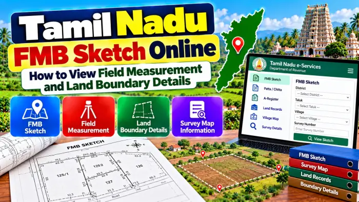
Tamil Nadu provides digital access to FMB-related land records through its land e-Services. For applicable rural properties, users can search using details such as District, Taluk, Village, Survey Number and Sub-Division Number.
A Tamil Nadu FMB Sketch Online search can be particularly useful for landowners, farmers, buyers and legal heirs who want to compare survey measurements with other property documents.
However, an online FMB sketch should be used as a survey reference. If there is a serious boundary dispute or a need to physically identify the boundary on the ground, an official survey or demarcation may still be necessary.
Tamil Nadu FMB Sketch – Quick Overview
| Details | Information |
|---|---|
| State | Tamil Nadu |
| Record Name | FMB Sketch |
| Full Form | Field Measurement Book |
| Record Type | Survey / Measurement Record |
| Main Purpose | View parcel measurement and survey details |
| Main Identifier | Survey Number |
| Additional Identifier | Sub-Division Number |
| Rural Location Details | District, Taluk and Village |
| Related Record | Patta / Chitta |
| Village Record | A-Register |
| Urban Survey Record | TSLR |
| Online Facility | Tamil Nadu Land e-Services |
| Physical Boundary Check | Official survey may be required |
| Ownership Proof | Not standalone title proof |
What Is an FMB Sketch in Tamil Nadu?
FMB stands for Field Measurement Book.
An FMB sketch is a survey-related drawing associated with a particular survey field or subdivision. It helps represent the surveyed parcel and its measurement information in a visual form.
Unlike a Patta or A-Register extract, which primarily presents land information as text, the FMB is useful when you want to understand the physical representation of a surveyed parcel.
It can therefore become important when comparing a property document with survey information or when checking how a subdivision is represented in government survey records.
What Information Can an FMB Sketch Show?
An FMB sketch focuses mainly on survey and measurement information.
Depending on the applicable record, it can help users understand the shape of the surveyed parcel, boundary lines, measurements, survey references and subdivisions.
It may also help identify adjoining survey or subdivision references.
The information should always be matched with the correct survey number and subdivision.
An FMB sketch is not intended to replace every other property record. It works best when compared with Patta/Chitta, A-Register information and the registered property document.
What Is a Survey Number?
A Survey Number is an important identifier assigned to a surveyed land parcel or field.
In Tamil Nadu, survey numbers are commonly found in property documents and land records.
The same survey number can appear in records such as Patta/Chitta, A-Register and FMB.
When checking an FMB sketch, make sure the survey number belongs to the correct District, Taluk and Village.
A numerical survey number alone is not enough to identify land across Tamil Nadu because similar numbers can exist in different villages.
What Is a Sub-Division Number?
A survey field can be divided into smaller portions.
When such division is reflected in the survey records, separate Sub-Division Numbers may be used to distinguish individual portions.
This makes the subdivision particularly important when checking FMB information.
Two properties may share the same original survey number but relate to different subdivisions.
If your registered deed contains both a survey number and subdivision number, compare the complete reference with the FMB record.
Checking only the main survey number could result in viewing the wrong portion.
Details Required to Check FMB Sketch Online
Before searching for a Tamil Nadu FMB Sketch, collect the property information from your existing documents.
The main details generally required for rural land include:
District
Taluk
Village
Survey Number
Sub-Division Number
These details may be available in your sale deed, Patta/Chitta, A-Register extract or another survey-related document.
Make sure the spelling and location details are correct before beginning the search.
How to View Tamil Nadu FMB Sketch Online
Start with the official Tamil Nadu Land Records e-Services.
Choose the facility for viewing Patta/Chitta/FMB records or the applicable FMB Sketch service.
Select the correct District.
Next, select the Taluk and Village in which the property is situated.
Enter or select the Survey Number.
Choose the applicable Sub-Division Number where required.
Complete any verification requested by the current system and submit the information.
The available FMB sketch or related record can then be reviewed.
Government portals can change their interface over time, so follow the instructions currently displayed on the official service.
How to Read an FMB Sketch
An FMB sketch can look more technical than a normal property document because it is based on survey information.
Begin by confirming the Survey Number and Sub-Division Number.
Next, identify the outline or shape associated with the parcel.
Look at the measurement markings and adjoining survey references shown in the sketch.
Compare these details with your registered deed and other survey information.
If you are unfamiliar with technical survey measurements, avoid making assumptions based solely on the drawing. A qualified survey professional can help interpret the record when exact physical measurements are important.
FMB Sketch vs Patta
Patta and FMB are different records.
Patta is associated with the landholding and recorded pattadar information in the revenue system.
FMB focuses on survey measurement and the spatial representation of the land parcel.
For example, Patta can help identify the applicable landholding, while the FMB can provide additional survey-related information about the parcel.
Checking both records can therefore be useful during property verification.
Neither should automatically replace the registered title document.
FMB Sketch vs A-Register
The A-Register is an important village land record containing survey and revenue-related information.
It can provide details associated with the survey field, including applicable classification and extent information.
FMB provides a more measurement-oriented visual survey record.
Therefore, an A-Register entry and an FMB sketch can complement each other.
When verifying land, compare the Survey Number and Sub-Division Number across both records to ensure you are reviewing the same property.
FMB Sketch vs TSLR
FMB is commonly associated with applicable rural or Natham survey records.
For properties falling under town-survey or urban records, users may encounter TSLR, which stands for Town Survey Land Register.
Tamil Nadu's land-record e-Services support both rural and urban land records.
The details required can differ. Rural searches can use Taluk, Village, Survey Number and Sub-Division Number, while urban records can involve Town, Ward, Block and applicable survey details.
Choose the record type that applies to the property's location.
Can FMB Help Check Land Boundaries?
An FMB sketch can provide useful information about the surveyed parcel and recorded measurements.
It can help a landholder compare the shape and measurements in the survey record with other documents.
However, an online sketch should not automatically be used to physically mark a disputed boundary on the ground.
Fences, walls, roads, old survey stones or neighbouring occupation may not necessarily correspond exactly with how someone interprets a digital sketch.
When exact boundary identification is necessary, the applicable official survey process is more appropriate.
FMB Sketch for Property Buyers
Checking FMB information can be useful before purchasing applicable land.
Start by checking the survey and subdivision numbers mentioned in the seller's registered documents.
Compare them with the FMB sketch.
Then review Patta/Chitta and A-Register information for the same parcel.
Pay attention to the recorded extent and whether the subdivision matches the portion being offered for sale.
For a significant property purchase, other checks such as prior title documents and applicable registration or encumbrance information may also be necessary.
What If FMB Measurements Do Not Match Your Documents?
A mismatch should be investigated carefully.
First, confirm that you selected the correct District, Taluk, Village, Survey Number and Sub-Division Number.
Next, compare the FMB with the registered deed, Patta/Chitta and A-Register.
A difference could be related to subdivision, an older survey record, a later survey update or another change affecting the land records.
Do not assume that an online record can be manually corrected immediately.
The appropriate Survey or Revenue authority may need to examine the records and supporting documents.
Can FMB Show the Exact Area of Land?
FMB information is useful for understanding survey measurements associated with a parcel.
However, users should distinguish between reading measurements from a survey record and determining the present physical area on the ground.
If exact current measurement is important, especially where there is a dispute or suspected encroachment, an official field survey can be necessary.
The survey professional can use the relevant government records and available survey references to identify the parcel on the ground.
Can FMB Help in a Boundary Dispute?
An FMB can be an important survey reference when a boundary issue arises.
It can help identify the recorded survey parcel, subdivision and measurement information.
However, the sketch itself does not automatically resolve a dispute between neighbouring owners.
A dispute may require an official survey, examination of registered documents, revenue records and, where necessary, appropriate legal proceedings.
Therefore, use the FMB as one part of the evidence rather than assuming that an online copy alone settles the matter.
Does an FMB Sketch Prove Ownership?
An FMB sketch is primarily a survey and measurement record.
It should not be treated as standalone proof of legal ownership.
Ownership or title may depend on registered sale deeds, gift deeds, inheritance documents, partition deeds, court orders and other legally relevant documents.
Patta and other revenue records may provide additional supporting information.
For complete property verification, survey, revenue and registration records should be examined together.
TamilNilam Geo-Info and FMB
Tamil Nadu also provides the TamilNilam Geo-Info application through the Tamil Nadu e-Governance Agency.
The application is a location-based map service of the Department of Survey and Settlement. It can visualize land-record details such as A-Register ownership and extent information, FMB sketches and Patta documents by navigating through the map or specific survey/subdivision details.
This provides another digital method for users to explore applicable land information.
Safety Tips While Checking FMB Online
Use Tamil Nadu's official government land-record services whenever possible.
Check the complete Survey Number and Sub-Division Number before relying on a result.
Avoid unknown agents or websites that promise instant changes to survey boundaries or official land records.
Do not share banking passwords, ATM PINs, UPI PINs or other sensitive financial information simply to view a land record.
For certified documents or official boundary action, use the applicable government procedure.
Frequently Asked Questions (FAQ)
1. What is an FMB Sketch in Tamil Nadu?
FMB stands for Field Measurement Book. The sketch is a survey-related record showing measurement and spatial information associated with a land parcel.
2. Can I view Tamil Nadu FMB Sketch online?
Tamil Nadu provides online land-record services through which applicable FMB information can be viewed.
3. What details are required to check an FMB?
For applicable rural land, District, Taluk, Village, Survey Number and Sub-Division Number are important search details.
4. What is a Survey Number?
A Survey Number identifies a surveyed parcel or field within the relevant village records.
5. Why is the Sub-Division Number important?
It helps identify a particular portion when an original survey parcel has been divided into multiple parts.
6. Is FMB the same as Patta?
No. Patta relates to landholding information, while FMB focuses primarily on survey measurements and parcel representation.
7. Is FMB the same as A-Register?
No. A-Register contains textual survey and revenue information, while FMB provides measurement-oriented survey information.
8. Can FMB help verify a land boundary?
It provides useful survey information, but an official field survey may be required for exact physical demarcation or disputes.
9. What should I do if my FMB does not match the sale deed?
Check the survey and subdivision details, compare other official records and contact the appropriate Survey or Revenue authority if the discrepancy remains.
10. Does an FMB Sketch prove land ownership?
No. It is a survey record. Complete ownership verification can require registered deeds and other applicable legal and revenue records.
Conclusion
Tamil Nadu FMB Sketch Online provides a convenient way to check survey measurement and land-boundary-related information for applicable properties. By using the correct District, Taluk, Village, Survey Number and Sub-Division Number, users can identify the relevant FMB information and compare it with their property documents.
FMB is particularly useful when reviewing survey measurements, parcel shape and subdivision information. For more complete verification, compare it with Patta/Chitta, A-Register and the registered deed.
Most importantly, remember that an online FMB sketch is a survey reference and not standalone proof of ownership or an automatic physical boundary certification. If there is uncertainty about measurements, encroachment or a boundary dispute, use the appropriate official survey and land-verification process.