UP BhuNaksha Online – View Village Maps and Land Plot Boundaries
Digital land-record services have made it easier for landowners, farmers, buyers and legal heirs to check property information without depending entirely on paper records. In Uttar Pradesh, UP BhuNaksha Online is an important service for viewing digitized cadastral or village maps and identifying individual land parcels.
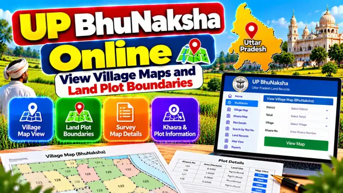
A BhuNaksha can help users visually locate a plot within a revenue village. By using the relevant Gata or Khasra Number, users can understand the position of a parcel in relation to nearby plots and compare map information with land records available through UP Bhulekh.
However, a digital map and a Khatauni serve different purposes. Khatauni mainly provides textual revenue and landholding information, while BhuNaksha provides the spatial or map-based representation of applicable parcels.
This guide explains how to use UP BhuNaksha Online, understand village maps and land plot boundaries, and compare map information with other important land records.
UP BhuNaksha Online – Quick Overview
| Details | Information |
|---|---|
| State | Uttar Pradesh |
| Map Service | BhuNaksha / Shajra |
| Authority | Board of Revenue, Uttar Pradesh |
| Main Purpose | View cadastral/village land maps |
| Parcel Reference | Gata / Khasra Number |
| Revenue Record | Khatauni |
| Village Map | Available for applicable digitized areas |
| Plot Location | Can be identified on applicable map |
| Plot Boundary | Visible as cadastral parcel boundary |
| Land Area | Check with applicable land records |
| Gata Boundary Service | Available |
| Gata Unique Code | Available |
| Sale Status | Available through Bhulekh |
| Dispute Status | Available through Bhulekh |
| Mutation Information | Available through applicable services |
What Is UP BhuNaksha?
UP BhuNaksha is a digital cadastral-map service used for viewing land parcels in Uttar Pradesh.
A cadastral map represents land parcels within a defined revenue area. Individual plots are generally identified through Gata or Khasra references.
Unlike a normal road map, a cadastral map focuses on land parcels and their arrangement.
This can help users understand where a particular plot is located within a village and how it is positioned in relation to surrounding parcels.
BhuNaksha should be used together with the relevant revenue records for better land verification.
What Is a Village Land Map?
A village land map, also called a cadastral map or Shajra in applicable land-record terminology, shows the layout of land parcels within a revenue village.
The map divides the area into different plots and displays their relative positions.
Each applicable parcel can be connected with a Gata/Khasra reference.
Village maps can therefore be helpful when a landowner knows a parcel number but wants to understand its approximate position among neighboring plots.
The Board of Revenue provides digital services related to revenue-village maps for applicable areas.
What Is a Gata Number?
A Gata Number identifies an individual land parcel within the relevant revenue village.
It is one of the most important references when working with UP's digital land-record services.
The Gata Number can connect a parcel with its Khatauni information, BhuNaksha and other applicable land-record services.
Because the same numerical number can potentially occur in different villages, never identify land using only the Gata Number.
Always verify the District, Tehsil and Village as well.
Gata Number vs Khasra Number
Both Gata and Khasra references are encountered in Uttar Pradesh land records.
They are associated with identifying individual parcels or fields in the relevant revenue context.
Older or existing property documents may contain Khasra references, while UP's digital land services frequently use Gata terminology.
When comparing different records, do not rely only on a matching number.
Confirm the Village, Khatauni, landholder information and other property details to ensure that you are looking at the correct parcel.
How to View UP BhuNaksha Online
Start with the official Uttar Pradesh BhuNaksha or Board of Revenue land-map service.
Select the appropriate location information displayed by the system.
Choose the correct District.
Select the relevant Tehsil.
Choose the revenue Village where the land is situated.
Open the applicable village map.
Locate or select the relevant Gata/Khasra Number according to the options provided by the current interface.
Review the parcel and surrounding plots on the map.
Government portals can be updated, so the exact menu names or interface may change over time.
How to Find Your Plot on the Village Map
Before opening BhuNaksha, keep your Gata or Khasra Number ready.
This number may be available in your Khatauni, registered deed, older revenue record or other property document.
After selecting the correct village, locate the applicable parcel.
Compare its number with your land record.
Also look at the surrounding parcel references.
This provides useful visual context and can help users understand the relative position of their plot within the village map.
How to Check Land Plot Boundaries
A cadastral map displays parcel lines that represent recorded plot boundaries in the map data.
After finding your Gata, examine the shape of the parcel and the neighboring plots.
The Uttar Pradesh Board of Revenue also provides an applicable service related to Gata boundaries or चौहद्दी.
This can provide additional information for understanding the parcel in relation to surrounding land.
However, viewing a boundary on a digital map is not the same as physically measuring and officially demarcating that boundary on the ground.
Can BhuNaksha Show Exact Physical Boundaries?
BhuNaksha is useful for understanding cadastral parcel boundaries, but users should be careful when an exact physical boundary is disputed.
A digital map is not automatically a substitute for an official field survey or demarcation procedure.
Differences can arise between old maps, ground conditions, physical possession and updated survey information.
If neighboring landowners disagree about the exact boundary, contact the appropriate Revenue or Survey authority and follow the applicable official procedure.
Do not resolve a boundary dispute only from a screenshot of an online map.
UP BhuNaksha and Khatauni
Khatauni and BhuNaksha provide different types of land information.
Khatauni is an important Record of Rights that can contain information related to the landholding, recorded landholder, Khata and Gata/Khasra details.
BhuNaksha provides the spatial representation of the parcel.
For better verification, first identify the correct Gata in the Khatauni and then compare it with the corresponding parcel on BhuNaksha.
This combination provides both textual and map-based information about the land.
How to Check Land Area
The area of a parcel should be checked from the applicable revenue record rather than estimated visually from the map.
UP land-record documentation can display the Gata/Khasra Number together with its recorded area.
After finding the parcel on BhuNaksha, open or check the corresponding Khatauni and compare the area.
If a landholding contains multiple Gata Numbers, review each parcel separately.
Do not assume that the total area of the broader Khata represents the area of one individual plot.
What Is a Khata Number?
A Khata Number is associated with a broader landholding account.
It is different from the Gata Number.
A single Khata can contain multiple individual land parcels, while each relevant Gata identifies a particular plot.
Therefore, a person viewing BhuNaksha should focus on the correct Gata when locating one specific field.
The associated Khatauni can then be used to understand how that parcel relates to the broader landholding.
What Is Gata Unique Code?
UP Bhulekh provides a service related to the Unique Code of a Bhukhand/Gata.
This gives the parcel another digital reference within the land-record system.
The Bhulekh system also indicates that applicable parcel-related information can be accessed through the Gata Unique Code.
This can include connections to BhuNaksha and other information such as sale, dispute and mutation-related records.
Always compare the unique code with the correct parcel and village details.
BhuNaksha and Gata Sale Status
UP Bhulekh provides an applicable service for checking the sale status of a Bhukhand/Gata.
If you are examining a parcel before a purchase, first identify the correct Gata on the land record and map.
Then check the available sale-related information.
Compare it with the seller's registered property documents.
BhuNaksha itself should not be used to determine whether a person legally owns the parcel or has the authority to sell it.
BhuNaksha and Disputed Land
The UP Bhulekh system also provides an applicable service for checking whether a Bhukhand/Gata is involved in a dispute or litigation.
This can be useful during preliminary land verification.
A person considering a property purchase can identify the Gata, check the map and then review the available dispute status.
However, an online result should not be treated as a complete legal investigation of every possible claim affecting a property.
BhuNaksha and Mutation Records
When rights in land change after a sale, inheritance or another qualifying event, the corresponding revenue record may require mutation or नामांतरण.
Mutation-related information can therefore be relevant when comparing a recent transaction with the current land records.
BhuNaksha identifies the parcel spatially, while mutation and Khatauni help users understand applicable changes in recorded rights.
A registered deed, mutation entry and cadastral map each serve different purposes.
What If the Plot Is Not Showing?
First verify the District, Tehsil, Village and Gata/Khasra Number.
Make sure you have selected the correct revenue village rather than another village with a similar name.
Compare the number with your current Khatauni or registered property document.
Some map information may also depend on digitization and current portal availability.
If the parcel cannot be located or there is a significant mismatch, contact the relevant Revenue or Survey authority rather than selecting a similar-looking plot.
What If the Map and Khatauni Do Not Match?
A mismatch should be investigated carefully.
Verify the Gata Number and location first.
Compare the current Khatauni, registered deed and available cadastral information.
Check whether the property has been subdivided or affected by an applicable mutation or survey-related update.
Do not alter or reinterpret parcel boundaries yourself.
If the discrepancy remains, use the appropriate official Revenue or Survey process to determine the correct record.
BhuNaksha Before Buying Land
BhuNaksha can be useful during preliminary property verification.
Identify every Gata included in the proposed transaction.
Check the current Khatauni and recorded landholder.
Compare the land area.
Locate the parcel on the village map.
Review neighboring parcels and applicable Gata boundary information.
Check available sale, dispute and mutation-related details.
Finally, compare the information with the registered deed and other legally relevant documents before making an important property decision.
Does BhuNaksha Prove Land Ownership?
No. A cadastral map primarily helps identify and understand the spatial position of a land parcel.
It does not by itself establish complete legal ownership.
Ownership verification may require the current Khatauni, registered sale deed, inheritance or succession documents, gift or partition documents, mutation records, court orders and other relevant records.
Therefore, BhuNaksha should be used as one component of broader property verification.
Frequently Asked Questions (FAQ)
1. What is UP BhuNaksha?
UP BhuNaksha is a digital cadastral-map service used to view applicable village land maps and parcels.
2. Can I view my village land map online?
Applicable digitized revenue-village maps can be accessed through the official land-map services.
3. What is required to find a plot?
The correct location and Gata/Khasra Number are particularly useful for identifying a parcel.
4. Can BhuNaksha show plot boundaries?
Yes. Cadastral maps display mapped parcel boundaries, but they should not replace official physical demarcation in a boundary dispute.
5. Can I check land area from BhuNaksha?
For reliable recorded area information, compare the parcel with the applicable Khatauni or revenue record rather than estimating area visually from the map.
6. What is a Gata Number?
A Gata Number identifies an individual land parcel within the relevant revenue village.
7. Is Gata Number the same as Khata Number?
No. Gata identifies a parcel, while Khata relates to the broader landholding account.
8. Can BhuNaksha show the landowner's name?
For recorded landholder information, check the corresponding Khatauni and applicable Bhulekh records.
9. What should I do if the map boundary is different on the ground?
Contact the appropriate Revenue or Survey authority and follow the applicable official survey or demarcation procedure.
10. Does UP BhuNaksha prove ownership?
No. Complete ownership verification can require Khatauni, registered deeds, mutation information and other relevant legal records.
Conclusion
UP BhuNaksha Online is a useful digital service for viewing village maps and land plot boundaries in Uttar Pradesh.
By identifying the correct District, Tehsil, Village and Gata/Khasra Number, users can locate an applicable parcel and understand its position relative to surrounding plots.
BhuNaksha becomes more useful when combined with UP Bhulekh Khatauni, land area information, Gata Unique Code, mutation records and applicable sale or dispute status.
Remember that an online cadastral map provides valuable parcel information but should not be treated as standalone proof of ownership or a replacement for official physical demarcation. For important land matters, compare the map with current revenue records, registered documents and applicable survey information.